About Puerto de Fray Bentos
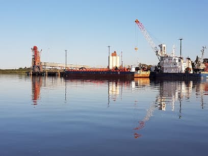
General description: Located on the right bank of the Uruguay River, 213 miles by river from Montevideo and 145 miles from Buenos Aires. In 1976 the International Bridge was inaugurated, spanning the River at km 101 and linking Uruguay with Argentina. The Bridge is 5,366 m long and 40 meters above the River. To get to Fray Bentos and from Km. 0 of the Uruguay River there are two passes, Paso Márquez and Paso Barrizal, with a draft of around 19'. at zero, normally the river level is around 21'. Port Characteristics: In Fray Bentos, the dock forms an "L", built in reinforced concrete offering docking space for two ships, it has a grain elevator connected by a conveyor belt located in the first section of the dock. The first section of the wharf is westbound, 200 m. long, 22 m. wide, equipped with railway line. Load rate approximately: 200 TPH. Terminales Graneleras Uruguayas S.A. It has a storage capacity of up to 20,000 tons. It also operates with other types of cargo such as citrus, round wood, etc. Fuel delivery: Only by truck. Repairs: Only minor repairs. Drinking water: Available. Medical Assistance: Available. State dock known as "Official Dock": Built of reinforced concrete from the ground, 84 meters long, 22 meters wide, attached to a 240-meter reinforced concrete pier, with a depth of 32' to zero. In 1991 it was extended to the north, adding a total of 320 meters. At the same time a conveyor belt was installed on the main dock and connected to the grain elevator tower on the expanded dock. Load rate: 4/500 TPH. Storage capacity of Terminales Graneleras Uruguayas S.A.: 70,000 tons. (wheat based). Vertical concrete silos, shed-silo and horizontal cell Thermometry and aeration system in all tanks The identity and traceability of the product are preserved. Two truck receiving platforms grain conditioning plant Medical Assistance: Available. Drinking water: Available. Repairs: Only minor repairs. Fuel delivery: Only by truck from Montevideo.
Facilities
Port Information
Telephone
Berth Sizes
Depth at MLW
Manoeuvrability
Port of Entry
Tidal Flow
Active Winter
Weather Forecast
 NE 10 knots decreasing to N 6 knots.
 11°C
11°C Mostly fine
- N 5–7 knots.
- 12 to 16°C
 UV Index: 0 - Low
- Mostly fine
- N 5 knots increasing to 7 knots.
- Decreasing from 14 to 10°C
- UV Index: 0 - Low
- Mostly fine