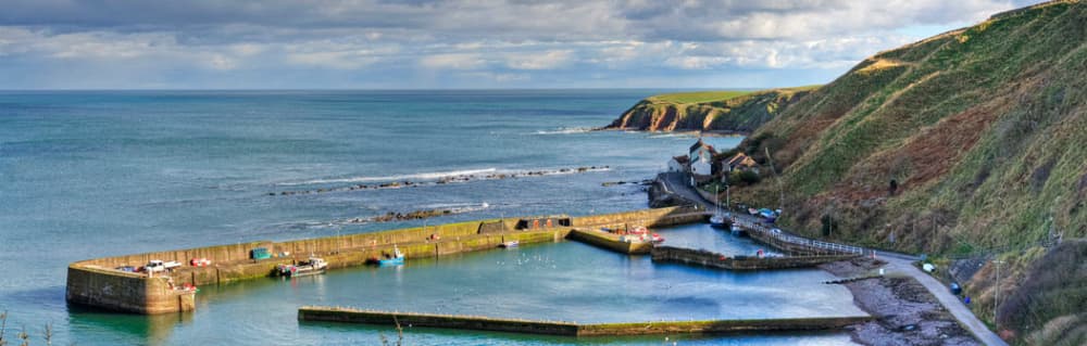
About Burnmouth Harbour
Burnmouth itself comprises a group of 5 villages. Part of it is at the foot of a deep ravine next to the port protected from the elements by dangerous rocks and reefs that form a natural barrier. It is used by various fishing and pleasure boats.
Facilities
COORDINATES
55.84229 N, -2.06735 E
Port Information
Telephone
Berth Sizes
< 10m
Depth at MLW
< 2m
Manoeuvrability
Fair
Channel Marking
Poor
Port of Entry
Yes
Overseas Visitor Berths
Yes
Dock Type
Fixed
Tidal Flow
Beware
Active Winter
Yes
Weather Forecast
Sat
5AM - 9AM
27 June 2026
 SW 10 knots increasing to 12 knots. Gusts up to 21 knots.
 Increasing from 15 to 19°C
 SE 0.5m at 4s period
 UV Index: 0 - Low
 Cloudy
Sat
9AM - 1PM
27 June 2026
- SW 13–15 knots. Gusts up to 23 knots.
- Increasing from 19 to 24°C
- SE 0.5m at 3s period
- UV Index: 5 - Moderate
- Cloudy
Sat
1PM - 5PM
27 June 2026
- SW 14 knots increasing to 17 knots. Gusts up to 27 knots.
- 22 to 26°C
- SE 0.5m at 3s period
- UV Index: 4 - Moderate
- Mostly fine