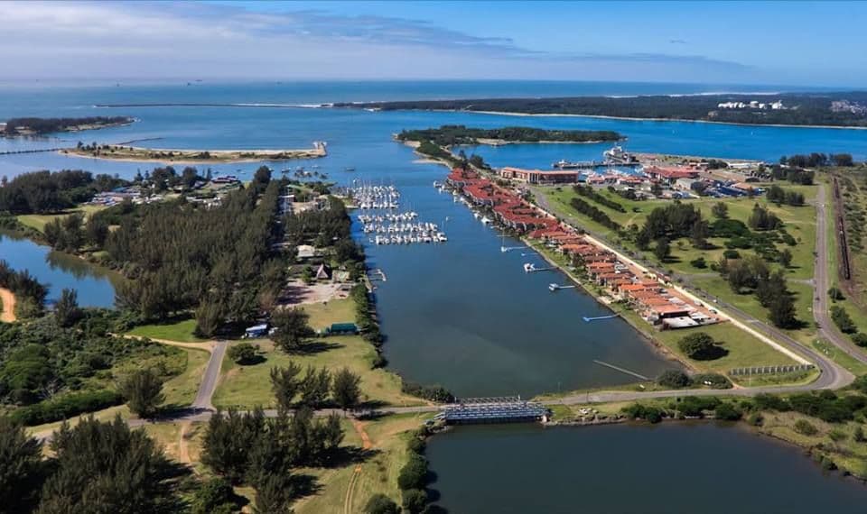
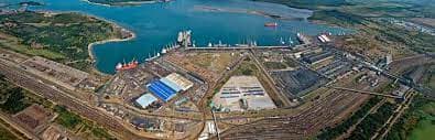
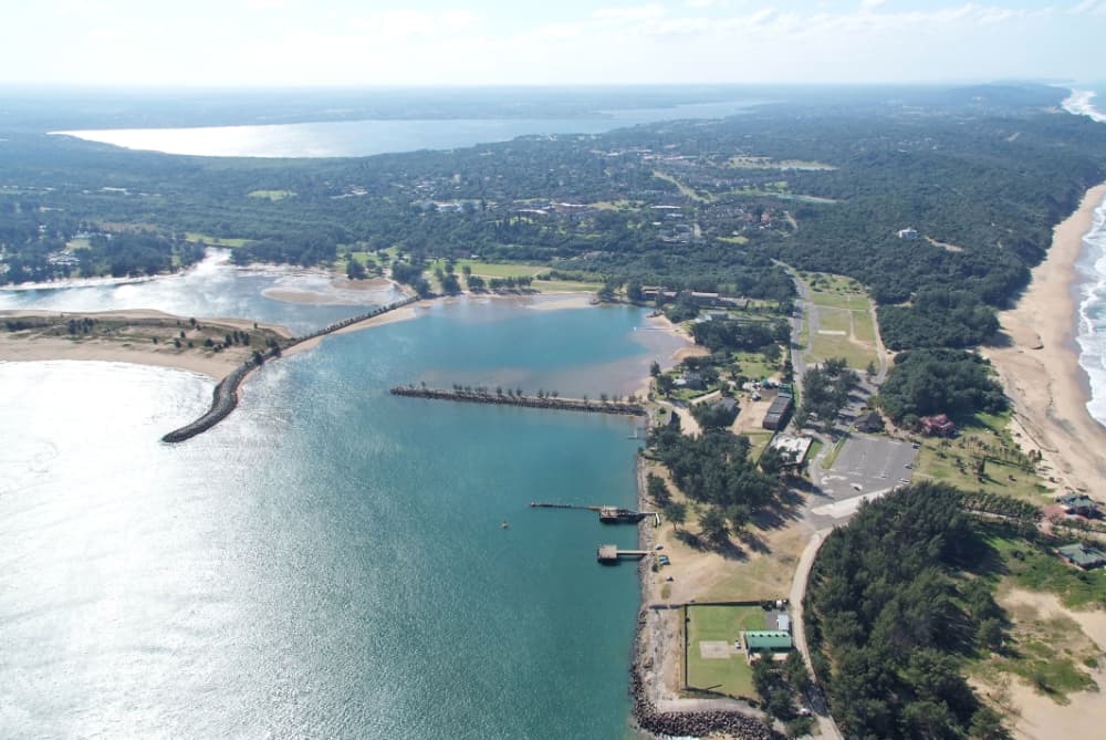
About Port of Richards Bay
Situated at Longitude 32º 02' E and Latitude 28º 48' S, Richards Bay, South Africa's most northernmost and easterly port, is 87 nautical miles (160 km) northeast of Durban and 252 n.miles (465 km) southwest of Maputo. The port with its immediate region has become a popular call for international cruising yachts because of the close proximity to game parks and the St Lucia World Heritage Site. Cruising yachts make use of the small craft berth where there is a modern marina (Zululand Yacht Club) near the small craft basin. The port of Richards Bay is open 24 hours a day 365 days a year. The entrance channel is dredged to a permissible draught of 17.5 metres with a -19,5m depth in the entrance channel. Berthing varies between 8m (small craft berth) and 19m (coal berths). The Port of Richards Bay is a Port of Entry/Departure, and the following procedures must be completed by all craft making their first landfall at this port from international waters Transnet National Ports Authority Port of Richards Bay PO Box 181 Richards Bay 3900 Tel (27) 035 905 3440 Fax 27) 035 905 3333 PORT MANAGER: Tel (27) 035 905 3203 Fax (27) 035 905 3333 email Preston.Khomo@transnet.net HARBOURMASTER (Marine): Tel (27) 035 753 1991 PORT CONTROL OFFICE (Ship Movements): Tel (27) 035 905 3444 Public Affairs & Marketing: Tel (27) 035 905 3417 email tessie.gower@transnet.net Richards Bay is SA's premier bulk port and the most modern. Although built in 1976 for the export of coal, it has since expanded into other bulk and breakbulk cargoes. http://www.transnetportterminals.net/ NOTICE TO ALL VESSELS ARRIVING FROM INTERNATIONAL WATERS Any vessel coming from International waters needs to register online with www.osasa.org.za for pre-arrival authorisation at least 96 hrs before arrival. It is preferable to do this before leaving the last port of departure for Richards Bay, South Africa. Once the registration has been completed, all the documents will be channelled to the correct departments and contact persons ahead of your arrival. On arrival call Port Control on CHANNEL 12 to request permission to enter harbour Upon entering the harbour, proceed to the Small Craft Harbour and tie up on the concrete wall in front of the Dros restaurant to await Port Health clearance. Make sure you are flying the Yellow Q flag. Port health will come to your boat once results are received by them, and so will Immigration. DO NOT LEAVE YOUR BOAT before being cleared by Port Health. Once cleared, Immigration will normally come to the boat to issue your visa. You have 24hrs from Immigration clearance to visit Customs. Contacts: Natasha Wolmarans OSASA representative natasha@osasa.org.za Port Manager: Tel (27) 035 905 3203 email Preston.Khomo@transnet.net Harbourmaster: Tel (27) 035 753 1991 Zululand Yacht Club welcomes visiting yachts. The Yacht Club office is open: Mon – Fri : 08:00 – 16:00 Sat: 08:00 – 12:00 Berthing: 0357880256 Email: admin@zyc.co.za Fiona Linde
Facilities
Port Information
Telephone
Berth Sizes
Depth at MLW
Manoeuvrability
Channel Marking
VHF Channel
Port of Entry
Overseas Visitor Berths
Catamaran Berths
Tidal Flow
Active Winter
Weather Forecast
 N 6–12 knots. Gusts up to 17 knots.
 Increasing from 16 to 19°C
 S 1.3m at 12s period
 UV Index: 0 - Low
 Mostly fine
- N 6–12 knots.
- Increasing from 20 to 25°C
- S 1.3-1.6m at 12s period
- UV Index: 3 - Moderate
- Mostly fine
- NE 11 knots increasing to 13 knots. Gusts up to 22 knots.
- 22 to 26°C
- S 1.7m at 11s period
- UV Index: 0 - Low
- Partly cloudy