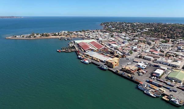
Port de Mahajanga
Facilities & Weather Forecast

Port de Mahajanga
Marina in Madagascar
MAHAJANGA/MAJUNGA is located in East Africa, East Africa in Madagascar. UN/Locode* : MGMJN MMSI MID code: 647 Geographical coordinates: Latitude: -15.7219563 Length: 46.3145828 Mahajanga Boulevard Point Carré Capitainerie du Port B.P. 36 GSM : + 261 32 11 257 44 Mahajanga is a port city on the northern coast of Madagascar. You can see palm trees and food stalls facing the sea, La Corniche. The
Show More
Port de Mahajanga Facilities
Petrol
Diesel
Toilets
Food
Haulout
Medical Facilities
Markets
Rigger
Customs Clearance
-15.72585 N, 46.30689 E
Port de Mahajanga Information
Active Winter Community?
Yes
Manoeuvrability
Fair
Dock Type
Floating
Depth at MLW
3m+
Current/Tidal Flow
Negligible
Port of Entry
Yes
Visitor Berths
Yes
Telephone
+261 32 11 257 44Email
apmf@apmf.mgPort de Mahajanga Weather Forecast
Wed
5AM - 9AM
31 December 2025
- Light and variable.
- 29°C
- Calm sea
- UV Index: 6 - High
- Cloudy
Wed
9AM - 1PM
31 December 2025
- S 3 knots increasing to NE 6 knots.
- 30°C
- Calm sea
- UV Index: 12 - Extreme
- Cloudy
Wed
1PM - 5PM
31 December 2025
- NW 3–11 knots.
- 30°C
- Calm sea
- UV Index: 12 - Extreme
- Chance of showers
