About Puerto Natales Terminal
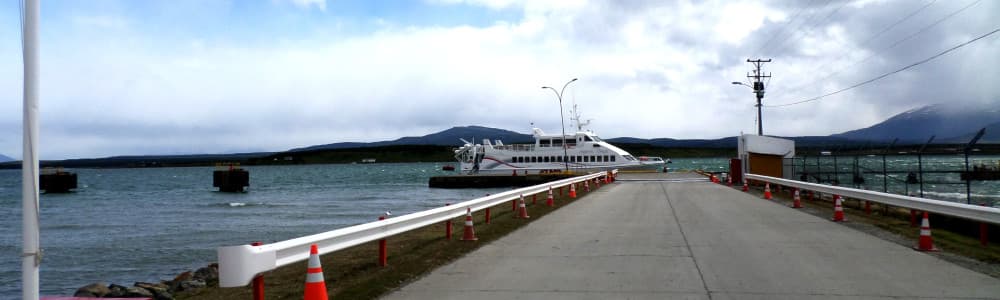
Puerto Natales Terminal Considered as the terminal and continuation of the South Austral Longitudinal Highway, at the end of the 70s, its construction began, which currently consists of a 33-meter-long “L” type dock, also has a platform of 10 meters wide and a 100 meter long full stone access bridge. Since the 1980s, when it came into operation, it was dedicated to providing service to the Roll-on type ship system. Its structure also allows it to receive commercial ships and light tourist cruises that arrive in the city, thus it also serves as a shelter for fishing vessels that are sheltered in their interior sites. In 2003 a Passenger Lounge was inaugurated, which was oriented to the attention of tourists and passengers who use the ferry. It has 300 square meters of surface, implemented with basic services, central heating and all the comforts of facilities of this type framed in international standards of quality and comfort.
Facilities
Port Information
Telephone
Berth Sizes
Depth at MLW
Manoeuvrability
Channel Marking
Port of Entry
Overseas Visitor Berths
Dock Type
Tidal Flow
Active Winter
Weather Forecast
 N 3–5 knots.
 1°C
1°C Chance of showers
- Light and variable.
- 0 to 2°C
- Chance of showers
- W 6–9 knots. Gusts up to 20 knots.
- 3°C
 UV Index: 0 - Low
- Partly cloudy