Montauk Marine Basin
Facilities & Weather Forecast


Montauk Marine Basin
Marina in United States
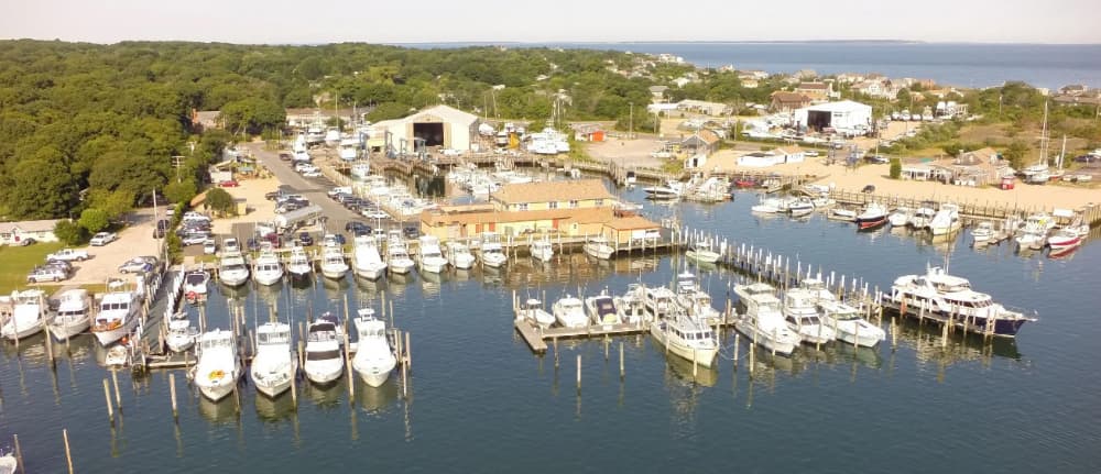
Located only minutes from Montauk Inlet, when entering harbor going past the commercial fleet stay to the right (Western Heading) and look for the Montauk Marine Basin fuel dock sign. Pictured here is the harbor entrance looking north east. Montauk Marine Basin monitors VHF Channel 19. Call us for berth info, fuel dock clearance or a radio check. We are close to motels, restaurants, golf, tennis,
Show More
Montauk Marine Basin Servizi
Elettricità
Benzina
Diesel
Acqua
Wifi
Docce
Acque Reflue
Toilette
Cibo
Bar
Costruttore di Barche
Lavanderia
Alaggio
Supermercato
41.07281 N, -71.93888 E
Montauk Marine Basin Information
Comunità Attiva in Inverno?
Yes
Manovrabilità
Fair
Approcci e Segnalazione dei Canali
Fair
Tipo di Molo
Fixed
Stile
Stern to
Porto di Entrata
No
Ormeggi per Visitatori
Yes
Telefono
+1 631-668-5900Canale VHF
19
Montauk Marine Basin Weather Forecast
Tue
5AM - 9AM
13 January 2026
- W 14 knots decreasing to 12 knots. Gusts up to 20 knots.
- 1 to 3°C
- SW 0.8m at 4s period
- UV Index: 0 - Low
- Sunny
Tue
9AM - 1PM
13 January 2026
- W 10–13 knots.
- 1 to 4°C
- SW 0.6m at 4s period
- UV Index: 1 - Low
- Sunny
Tue
1PM - 5PM
13 January 2026
- SW 7–17 knots. Gusts up to 22 knots.
- 3 to 5°C
- SW 0.6m at 4s period
- UV Index: 0 - Low
- Partly cloudy
